New Uwharries guide makes exploring easy
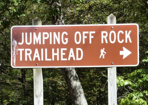
The Uwharrie National Forest sprawls across three counties with numerous access points, but actually getting out on the trails can be intimidating for locals and visitors alike. Many entrances consist of nothing more than a forbidding yellow gate. The U.S. Forest Service might claim foot traffic is welcome, but without additional signage to indicate where a trail might lead, there’s a foreboding sense of entering at your own risk.
A surprising number of people in the Uwharries have never set foot on these trails, despite having them run – sometimes literally – right through their own backyards. It can be even more daunting for people from out of town. The first time friends of mine from Charlotte ventured out to the Uwharries, they ended up on a busy motorized vehicle trail in the Badin Lake Recreation Area – the perfect place for those who want to test their off-road skills, but not for those who want a solitary hike.
The Forest Service does an admirable job managing the land, but the staff doesn’t have the capacity to roll out a welcome mat and craft an itinerary for each visitor. Fortunately, author Don Childrey caters to the individual needs of hikers, mountain bikers, equestrians and off-road enthusiasts in his book, “Uwharrie Lakes Region Trail Guide.” The second edition was published this fall.
Childrey grew up in Burlington. Like many young men in the Piedmont, he discovered the Uwharries through his Boy Scout  troop. He calls it “a great destination for beginning hikers and backpackers.” On his website, he notes the area is within a two-hour drive of more than 8 million people. The trails offer a sense of isolation without being excessively remote. But even the seasoned hiker soon realizes our worn-down mountains “still retain enough elevation change to make you earn the top of each hill.” With Childrey’s assistance, it’s possible to find trails and trips to suit a range of interests and abilities.
Childrey aims to make his guide as accessible as the trails. He provides a quick reference table at the end of the book. The Uwharrie Trip Finder lists information – including length, elevation change, difficulty, trailhead, trail type and camping options – for 54 itineraries. They range from a leisurely stroll on the fairly flat, mile-long Denson’s Creek Trail to a multiday trek on the Uwharrie National Recreational Trail with almost 3 vertical miles of elevation change over a distance of nearly 40 miles. Each trip has its own map and a graphic elevation profile. There are seven trip options just in the Birkhead Wilderness Area. Childrey also includes information about the trails at Morrow Mountain State Park.
The first edition of his book appeared in 1998, but within 10 years Childrey realized an update was in order. He wanted to include information about the equestrian trails in the Badin Recreation Area and the changes to some of the mountain bike trails in the Wood Run Area. During his revision process, The LandTrust for Central North Carolina purchased tracts of land to create new trailheads and help restore the Uwharrie Trail to its historic length. As a result, the new edition of Childrey’s guide is more than 200 pages longer than the original. It describes an additional 80-plus miles of trail and suggests twice as many trips, enough to keep any outdoor enthusiast returning to the Uwharries forests for many years to come.
“Uwharrie Lakes Region Trail Guide” remains the only comprehensive guide to our region. For more information, go to Childrey’s site. All books ordered through the website will be signed by the author.